Nigeria Google maps and Driving Directions
Get free driving directions, Google maps, traffic information for Nigeria, and Abuja (GPS: 9 05 N 7 32 E), the capital city of the country located in (the) Western Africa, bordering the Gulf of Guinea, between Benin and Cameroon.
Find any address in Abuja on the Google map of Nigeria (NG) with ease or calculate your up to date itinerary to and from Nigeria or its neighboring counties like Benin, Cameroon, Chad, Niger.
Sightseeing and exploring in Africa starts here, thanks to Google because its Earth Engine combines a multi-petabyte catalog of updated satellite imagery and geospatial datasets with planetary-scale analysis capabilities. Wonder the world, use the satellite map function of the Google maps to explore or see differences on the Earth’s surface, inland, or the surrounding areas of Nigeria.
Google Maps Nigeria
West Africas biggest nation, Nigeria is a federation of 36 states and the capital, Abuja. Dominated by military governments since 1966, democracy returned in 1999.
Nigeria is southern lowlands merge into central hills and plateaus; mountains in southeast, plains in north.
The map above fully covers Nigeria with its road routes from cities to towns, road intersections in any region, provinces, prefectures, also with free driving directions in Abuja or to the neighboring towns and countries. To look at the detailed map about a particular quarter in Abuja, please click on the area and zoom to the place you are interested in the Google maps of Nigeria (NG).
Be creative, use the extras of this Google map; This is a detailed, clear, zoomable, large road map of Nigeria with its administrative divisions; 36 states and 1 territory*; Abia, Adamawa, Akwa Ibom, Anambra, Bauchi, Bayelsa, Benue, Borno, Cross River, Delta, Ebonyi, Edo, Ekiti, Enugu, Federal Capital Territory*, Gombe, Imo, Jigawa, Kaduna, Kano, Katsina, Kebbi, Kogi, Kwara, Lagos, Nasarawa, Niger, Ogun, Ondo, Osun, Oyo, Plateau, Rivers, Sokoto, Taraba, Yobe, Zamfara.
The interactive map above is also may be used as the satellite map of Nigeria, or as a reverse search map for finding an address from its GPS coordinates.
Nigeria, one-third larger than Texas and the most populous country in Africa, is situated on the Gulf of Guinea in West Africa. Its neighbors are Benin, Niger, Cameroon, and Chad. The lower course of the Niger River flows south through the western part of the country into the Gulf of Guinea. Swamps and mangrove forests border the southern coast inland are hardwood forests.
Nigeria (area: 923 768 sq km / 356 668,67 sq mi), where the official language is English, lying in Africa and using the currency; Nigerian naira (NGN), since 1973, set their clock to UTC+1. That means they are 6 hours ahead of Washington DC during Standard Time in Abuja, the capital. Note to the time difference: N/A.
The climate in Nigeria; The south is hot, rainy and humid for most of the year. The arid north has one very humid wet season. The Jos Plateau and highlands are cooler.
Geography in a nutshell; Coastal area of beaches, swamps, and lagoons gives way to rainforest, and then to savanna on the high plateaus. Semidesert to the north.
Click here for more detailed information about Nigeria.
Driving directions Nigeria
The Google maps and Google Satellite maps of Nigeria above showing the country, located next to Benin, Cameroon, Chad, Niger. For your further reference, the latitude and longitude coordinates of Nigeria are 10 00 N, 8 00 E , while the capital, Abuja found at 9 05 N 7 32 E.
When you are traveling around Nigeria, Abuja, or its other cities, use this routing tool, providing up to date route planning service free of charge.
Look no further; get accurate driving directions in Nigeria, Africa, by filling the route planner form below.
Since Google acquired and introduced its digitalized maps in 2004, you’re probably familiar with its base functions, like finding an address or driving directions to locations. Still, Google maps also accommodate bicyclists, pedestrians, and also public transportation with special directions and customizable routes.
About Nigeria and the capital, Abuja
 |
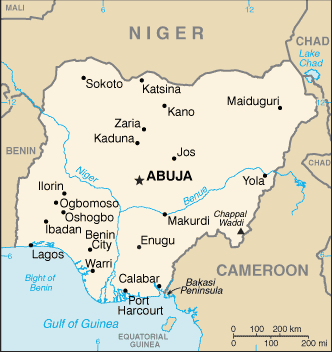 |
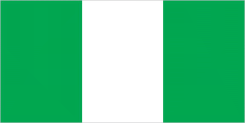
| The national flag of Nigeria | Borderline map of Nigeria |
| Flag description: three equal vertical bands of green (hoist side), white, and green; the color green represents the forests and abundant natural wealth of the country, white stands for peace and unity. | Border length: total: 4,477 km. Border countries (total: 4): Benin 809 km, Cameroon 1,975 km, Chad 85 km, Niger 1,608 km. |
Did you know about Nigeria?
- Nigeria formed in 1914 from several British colonies and protectorates. In 1954 it became a federation and in 1960 achieved independence.
- Nigeria is Africas most populous state one in every seven Africans is Nigerian.
- Africas most populated nation and the 10th most populated country in the world, Nigeria is home to many diverse groups of peoples. Approximately 250 different ethnic groups live here, speaking numerous languages, although English-the former colonial language-is the only official language.
Facts of Nigeria (NG)
Name conventional long form: Federal Republic of Nigeria, conventional short form: Nigeria, etymology: named for the Niger River that flows through the west of the country to the Atlantic Ocean; from a native term “Ni Gir” meaning “River Gir”
Codes: ISO; NG, Internet; .ng
Capital city: Abuja
Language(s): English (official language), Hausa, Yoruba, Igbo (Ibo), Fulani, over 500 additional indigenous languages
National holiday(s): Independence Day (National Day), 1 October (1960)
Motto: Unity and Faith, Peace and Progress
Currency: Nigerian naira (NGN), since 1973
GPS: 10 00 N, 8 00 E, Abuja; 9 05 N 7 32 E
Location: Western Africa, bordering the Gulf of Guinea, between Benin and Cameroon
Geography note: the Niger River enters the country in the northwest and flows southward through tropical rain forests and swamps to its delta in the Gulf of Guinea
Land boundaries: Benin 809 km, Cameroon 1,975 km, Chad 85 km, Niger 1,608 km, total: 4,477 km
Maritime boundaries: N/A
Coastline: 853 km
Area: total: 923,768 sq km; land: 910,768 sq km, water: 13,000 sq km (total 356 668,67 mi2), about six times the size of Georgia; slightly more than twice the size of California.
Roadways: total: 193,200 km, paved: 28,980 km, unpaved: 164,220 km (2004)
Waterways: 8,600 km (Niger and Benue Rivers and smaller rivers and creeks) (2011)
Local time (capital): UTC+1, 6 hours ahead of Washington DC during Standard Time
Note to the local time: N/A
Population in Nigeria: 195 875 237
Population in Abuja: 590 400 (including the metropolitan areas)
Urbanization: urban population: 47.8% of total population (2015)
Major urban areas population: Lagos 13.123 million; Kano 3.587 million; Ibadan 3.16 million; ABUJA (capital) 2.44 million; Port Harcourt 2.343 million; Benin City 1.496 million (2015)
Population growth rate: 2.44% (2016 estimate)
Birth rate: 37.3 births / 1,000 population (2016 estimate)
Death rate: 12.7 deaths / 1,000 population (2016 estimate)
Age structure: 0-14 years: 42.79% (male 40,744,956 / female 38,870,303) 15-24 years: 19.48% (male 18,514,466 / female 17,729,351) 25-54 years: 30.65% (male 29,259,621 / female 27,768,368) 55-64 years: 3.96% (male 3,595,293 / female 3,769,986) 65 years and over: 3.12% (male 2,754,040 / female 3,047,002) (2016 estimate)
Median age: total: 18.3 years; male: 18.2 years, female: 18.4 years (2016 estimate)
Ethnic groups: Nigeria, Africa’s most populous country, is composed of more than 250 ethnic groups; the most populous and politically influential are: Hausa and the Fulani 29%, Yoruba 21%, Igbo (Ibo) 18%, Ijaw 10%, Kanuri 4%, Ibibio 3.5%, Tiv 2.5%
Religions: Muslim 50%, Christian 40%, indigenous beliefs 10%
Government type: Federal presidential republic
Legal system: mixed legal system of English common law, Islamic law (in 12 northern states), and traditional law
National anthem: Arise, O Compatriots
Known national hazards: periodic droughts; flooding
Major infectious diseases: The degree of risk(s): very high food or waterborne diseases: bacterial and protozoal diarrhea, hepatitis A and E, and typhoid fever vectorborne diseases: malaria, dengue fever, and yellow feverwater contact diseases: leptospirosis and schistosomiasisrespiratory disease: meningococcal meningitisaerosolized dust or soil contact disease: Lassa feveranimal contact disease: rabies (2016)
Land use: agricultural land: 78%; arable land 37.3%; permanent crops 7.4%; permanent pasture 33.3%; forest: 9.5%; other: 12.5% (2011 estimate)
Agricultural products: cocoa, peanuts, cotton, palm oil, corn, rice, sorghum, millet, cassava (manioc, tapioca), yams, rubber; cattle, sheep, goats, pigs; timber; fish
Industries: crude oil, coal, tin, columbite; rubber products, wood; hides and skins, textiles, cement and other construction materials, food products, footwear, chemicals, fertilizer, printing, ceramics, steel
Export commodities: petroleum and petroleum products 95%, cocoa, rubber (2012 estimate)
Main export partners: India 18.2%, Netherlands 8.5%, Spain 8.2%, Brazil 8.2%, South Africa 7.8%, France 5.2%, Japan 4.5%, Cote dIvoire 4.2%, Ghana 4% (2015)
Import commodities: machinery, chemicals, transport equipment, manufactured goods, food and live animals
Main import partners: China 25.7%, US 6.4%, Netherlands 6.1%, India 4.3% (2015)
Navigate the countries in Africa faster and easier while driving, use the interactive Google maps for your driving directions. The continuously updated database contains over 220 countries and territories digitally mapped, hundreds of millions of businesses and places around the world positioned on the map.
Get fresh GPS navigation, traffic, and transit information – no matter what part of Nigeria, Abuja, any other city and country in Africa, or the world you’re in.
Do you like this Nigeria information page? Please don’t forget to share it with others! Thank you.