Indonesia Google maps and Driving Directions
Get free driving directions, Google maps, traffic information for Indonesia, and Jakarta (GPS: 6 10 S 106 49 E), the capital city of the country located in (the) Southeastern Asia, archipelago between the Indian Ocean and the Pacific Ocean.
Find any address in Jakarta on the Google map of Indonesia (ID) with ease or calculate your up to date itinerary to and from Indonesia or its neighboring counties like East Timor, Malaysia, Papua New Guinea.
Sightseeing and exploring in Asia starts here, thanks to Google because its Earth Engine combines a multi-petabyte catalog of updated satellite imagery and geospatial datasets with planetary-scale analysis capabilities. Wonder the world, use the satellite map function of the Google maps to explore or see differences on the Earth’s surface, inland, or the surrounding areas of Indonesia.
Google Maps Indonesia
Formerly called the Dutch East Indies, Indonesia is the worlds largest archipelago, with 18,108 islands scattered across 3000 miles (5000 km). It is the worlds fourth most populous nation.
Indonesia is mostly coastal lowlands; larger islands have interior mountains.
The map above fully covers Indonesia with its road routes from cities to towns, road intersections in any region, provinces, prefectures, also with free driving directions in Jakarta or to the neighboring towns and countries. To look at the detailed map about a particular quarter in Jakarta, please click on the area and zoom to the place you are interested in the Google maps of Indonesia (ID).
Be creative, use the extras of this Google map; This is a detailed, clear, zoomable, large road map of Indonesia with its administrative divisions; 31 provinces (provinsi-provinsi, singular – provinsi), 1 autonomous province*, 1 special region** (daerah-daerah istimewa, singular – daerah istimewa), and 1 national capital district*** (daerah khusus ibukota); Aceh*, Bali, Banten, Bengkulu, Gorontalo, Jakarta Raya***, Jambi, Jawa Barat (West Java), Jawa Tengah (Central Java), Jawa Timur (East Java), Kalimantan Barat (West Kalimantan), Kalimantan Selatan (South Kalimantan), Kalimantan Tengah (Central Kalimantan), Kalimantan Timur (East Kalimantan), Kalimantan Utara (North Kalimantan), Kepulauan Bangka Belitung (Bangka Belitung Islands), Kepulauan Riau (Riau Islands), Lampung, Maluku, Maluku Utara (North Maluku), Nusa Tenggara Barat (West Nusa Tenggara), Nusa Tenggara Timur (East Nusa Tenggara), Papua, Papua Barat (West Papua), Riau, Sulawesi Barat (West Sulawesi), Sulawesi Selatan (South Sulawesi), Sulawesi Tengah (Central Sulawesi), Sulawesi Tenggara (Southeast Sulawesi), Sulawesi Utara (North Sulawesi), Sumatera Barat (West Sumatra), Sumatera Selatan (South Sumatra), Sumatera Utara (North Sumatra), Yogyakarta**note: following the implementation of decentralization beginning on 1 January 2001, regencies and municipalities have become the key administrative units responsible for providing most government services.
The interactive map above is also may be used as the satellite map of Indonesia, or as a reverse search map for finding an address from its GPS coordinates.
Indonesia is an archipelago in Southeast Asia consisting of 17,000 islands (6,000 inhabited) and straddling the equator. The largest islands are Sumatra, Java (the most populous), Bali, Kalimantan (Indonesia’s part of Borneo), Sulawesi (Celebes), the Nusa Tenggara islands, the Moluccas Islands, and Irian Jaya (also called West Papua), the western part of New Guinea. Its neighbor to the north is Malaysia and to the east is Papua New Guinea. Indonesia, part of the ring of fire, has the largest number of active volcanoes in the world. Earthquakes are frequent. Wallace’s line, a zoological demarcation between Asian and Australian flora and fauna, divides Indonesia.
Indonesia (area: 1 910 930 sq km / 737 813,89 sq mi), where the official language is Indonesian, lying in Asia and using the currency; Indonesian rupiah (IDR), since 1949, set their clock to UTC+7. That means they are 12 hours ahead of Washington DC during Standard Time in Jakarta, the capital. Note to the time difference: Indonesia has three time zones.
The climate in Indonesia; The climate is predominantly tropical monsoon. Variations relate mainly to differences in latitude and altitude; hilly areas are cooler overall. Rain falls throughout the year, often in thunderstorms, but there is a relatively dry season from June to September.
Geography in a nutshell; Indonesia is highly mountainous, with numerous tropical swamps. The land is covered with dense rainforest, especially on New Guinea, where it remains largely unexplored. There are more than 200 volcanoes, many of which are still active. Earthquakes, eruptions, and tsunamis are hazards. The islands of Java, Bali, Lombok, Sumatra, and Borneo were once joined together by dry land, which has since been submerged by rising sea levels. Coastal lowland development distinguishes some of the large islands.
Click here for more detailed information about Indonesia.
Driving directions Indonesia
The Google maps and Google Satellite maps of Indonesia above showing the country, located next to East Timor, Malaysia, Papua New Guinea. For your further reference, the latitude and longitude coordinates of Indonesia are 5 00 S, 120 00 E , while the capital, Jakarta found at 6 10 S 106 49 E.
When you are traveling around Indonesia, Jakarta, or its other cities, use this routing tool, providing up to date route planning service free of charge.
Look no further; get accurate driving directions in Indonesia, Southeast Asia, by filling the route planner form below.
Since Google acquired and introduced its digitalized maps in 2004, you’re probably familiar with its base functions, like finding an address or driving directions to locations. Still, Google maps also accommodate bicyclists, pedestrians, and also public transportation with special directions and customizable routes.
About Indonesia and the capital, Jakarta
 |
 |
| The national flag of Indonesia | Borderline map of Indonesia |
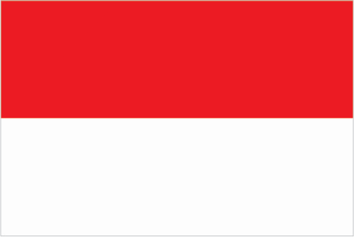
| Flag description: two equal horizontal bands of red (top) and white; the colors derive from the banner of the Majapahit Empire of the 13th-15th centuries; red symbolizes courage, white represents purity. Note: similar to the flag of Monaco, which is shorter; also similar to the flag of Poland, which is white (top) and red. | Border length: total: 2,958 km. Border countries (total: 3): Timor-Leste 253 km, Malaysia 1,881 km, Papua New Guinea 824 km. |
Did you know about Indonesia?
- A former Dutch colony, Indonesia gained independence in 1949. Western New Guinea (Irian Jaya) ceded to Indonesia in 1963.
- Indonesia has a very youthful population: almost 30% of its people are under 15 years of age.
- Gamelans-tuned percussion orchestras-accompany dancers in ritual and religious ceremonies.
Facts of Indonesia (ID)
Name conventional long form: Republic of Indonesia, conventional short form: Indonesia, local long form: Republik Indonesia, local short form: Indonesia, former: Netherlands East Indies, Dutch East Indies, etymology: the name is an 18th-century construct of two Greek words, “Indos” (India) and “nesoi” (islands), meaning “Indian islands”
Codes: ISO; ID, Internet; .id
Capital city: Jakarta
Language(s): Bahasa Indonesia (official language, modified form of Malay), English, Dutch, local dialects (of which the most widely spoken is Javanese). Note: more than 700 languages are used in Indonesia
National holiday(s): Independence Day, 17 August (1945)
Motto: Unity in Diversity
Currency: Indonesian rupiah (IDR), since 1949
GPS: 5 00 S, 120 00 E, Jakarta; 6 10 S 106 49 E
Location: Southeastern Asia, archipelago between the Indian Ocean and the Pacific Ocean
Geography note: according to Indonesia’s National Coordinating Agency for Survey and Mapping, the total number of islands in the archipelago is 13,466, of which 922 are permanently inhabited (Indonesia is the world’s largest country comprised solely of islands); the country straddles the equator and occupies a strategic location astride or along major sea lanes from the Indian Ocean to the Pacific Ocean; despite having the fourth largest population in the world, Indonesia is the most heavily forested region on earth after the Amazon
Land boundaries: Timor-Leste 253 km, Malaysia 1,881 km, Papua New Guinea 824 km, total: 2,958 km
Maritime boundaries: N/A
Coastline: 54,716 km
Area: total: 1,904,569 sq km; land: 1,811,569 sq km, water: 93,000 sq km (total 737 813,89 mi2), slightly less than three times the size of Texas.
Roadways: total: 496,607 km, paved: 283,102 km, unpaved: 213,505 km (2011)
Waterways: 21,579 km (2011)
Local time (capital): UTC+7, 12 hours ahead of Washington DC during Standard Time
Note to the local time: Indonesia has three time zones
Population in Indonesia: 266 794 980
Population in Jakarta: 13 194 000 (including the metropolitan areas)
Urbanization: urban population: 53.7% of total population (2015)
Major urban areas population: JAKARTA (capital) 10.323 million; Surabaya 2.853 million; Bandung 2.544 million; Medan 2.204 million; Semarang 1.63 million; Makassar 1.489 million (2015)
Population growth rate: 0.89% (2016 estimate)
Birth rate: 16.4 births / 1,000 population (2016 estimate)
Death rate: 6.4 deaths / 1,000 population (2016 estimate)
Age structure: 0-14 years: 25.42% (male 33,435,020 / female 32,224,706) 15-24 years: 17.03% (male 22,397,086 / female 21,604,985) 25-54 years: 42.35% (male 55,857,415 / female 53,543,682) 55-64 years: 8.4% (male 9,918,897 / female 11,790,016) 65 years and over: 6.79% (male 7,630,251 / female 9,913,993) (2016 estimate)
Median age: total: 29.9 years; male: 29.3 years, female: 30.5 years (2016 estimate)
Ethnic groups: Javanese 40.1%, Sundanese 15.5%, Malay 3.7%, Batak 3.6%, Madurese 3%, Betawi 2.9%, Minangkabau 2.7%, Buginese 2.7%, Bantenese 2%, Banjarese 1.7%, Balinese 1.7%, Acehnese 1.4%, Dayak 1.4%, Sasak 1.3%, Chinese 1.2%, other 15% (2010 estimate)
Religions: Muslim 87.2%, Christian 7%, Roman Catholic 2.9%, Hindu 1.7%, other 0.9% (includes Buddhist and Confucian), unspecified 0.4% (2010 estimate)
Government type: Unitary presidential constitutional republic
Legal system: civil law system based on the Roman-Dutch model and influenced by customary law
National anthem: Indonesia Raya (Great Indonesia)
Known national hazards: occasional floods; severe droughts; tsunamis; earthquakes; volcanoes; forest fires, volcanism: Indonesia contains the most volcanoes of any country in the world – some 76 are historically active; significant volcanic activity occurs on Java, Sumatra, the Sunda Islands, Halmahera Island, Sulawesi Island, Sangihe Island, and in the Banda Sea; Merapi (elev. 2,968 m), Indonesia’s most active volcano and in eruption since 2010, has been deemed a Decade Volcano by the International Association of Volcanology and Chemistry of the Earth’s Interior, worthy of study due to its explosive history and proximity to human populations; other notable historically active volcanoes include Agung, Awu, Karangetang, Krakatau (Krakatoa), Makian, Raung, and Tambora
Major infectious diseases: The degree of risk(s): very high food or waterborne diseases: bacterial diarrhea, hepatitis A, and typhoid fever vectorborne diseases: dengue fever and malaria (2016)
Land use: agricultural land: 31.2%; arable land 13%; permanent crops 12.1%; permanent pasture 6.1%; forest: 51.7%; other: 17.1% (2011 estimate)
Agricultural products: rubber and similar products, palm oil, poultry, beef, forest products, shrimp, cocoa, coffee, medicinal herbs, essential oil, fish and its similar products, and spices
Industries: petroleum and natural gas, textiles, automotive, electrical appliances, apparel, footwear, mining, cement, medical instruments and appliances, handicrafts, chemical fertilizers, plywood, rubber, processed food, jewelry, and tourism
Export commodities: mineral fuels, animal or vegetable fats (includes palm oil), electrical machinery, rubber, machinery and mechanical appliance parts
Main export partners: Japan 12%, US 10.8%, China 10%, Singapore 8.4%, India 7.8%, South Korea 5.1%, Malaysia 5.1% (2015)
Import commodities: mineral fuels, boilers, machinery, and mechanical parts, electric machinery, iron and steel, foodstuffs
Main import partners: China 20.6%, Singapore 12.6%, Japan 9.3%, Malaysia 6%, South Korea 5.9%, Thailand 5.7%, US 5.3% (2015)
Navigate the countries in Southeast Asia faster and easier while driving, use the interactive Google maps for your driving directions. The continuously updated database contains over 220 countries and territories digitally mapped, hundreds of millions of businesses and places around the world positioned on the map.
Get fresh GPS navigation, traffic, and transit information – no matter what part of Indonesia, Jakarta, any other city and country in Asia, or the world you’re in.
Do you like this Indonesia information page? Please don’t forget to share it with others! Thank you.