Scotland Google maps and Driving Directions
Get free driving directions, Google maps, traffic information for Scotland, and Edinburgh (GPS: 55 57 N 3 11 W ), the capital city of the country located in (the) Western Europe. Scotland is a country that is part of the United Kingdom. It covers the northern third of the island of Great Britain, with a border with England to the southeast, and is surrounded by the Atlantic Ocean to the north and west, the North Sea to the northeast, the Irish Sea to the south, and more than 790 islands, including the Northern Isles and the Hebrides.
Find any address in Edinburgh on the Google map of Scotland (GB-SCT) with ease or calculate your up to date itinerary to and from Scotland or its neighboring counties like England, Ireland.
Sightseeing and exploring in Europe starts here, thanks to Google because its Earth Engine combines a multi-petabyte catalog of updated satellite imagery and geospatial datasets with planetary-scale analysis capabilities. Wonder the world, use the satellite map function of the Google maps to explore or see differences on the Earth’s surface, inland, or the surrounding areas of Scotland.
Google Maps Scotland
Separated from continental Europe by the English Channel, the UK consists of Great Britain (England, Wales, and Scotland), several smaller islands, and Northern Ireland.
The map above fully covers Scotland with its road routes from cities to towns, road intersections in any region, provinces, prefectures, also with free driving directions in Edinburgh or to the neighboring towns and countries. To look at the detailed map about a particular quarter in Glasgow, please click on the area and zoom to the place you are interested in the Google maps of Scotland (UK).
Scotland is largely a country of mountains, rolling hills, and lochs, renowned for the beauty of its scenery. It divided into three distinct topographical regions: the Southern Uplands, the Central Lowlands and the Highlands. The Scottish coastline is deeply indented, and there are hundreds of offshore islands. The largest island groups are the Western Isles and the Orkney and Shetland Islands in the far north. Another feature of the Scottish landscape is its numerous lochs. Two of the most famous are Loch Lomond and Loch Ness, both of which have attracted tourists for many years.
The Central Valley of Scotland is the industrial heartland of the country and its most densely populated area. It is here that the capital, Edinburgh, and the largest city, Glasgow, are situated.
Scotland’s countryside provides a habitat for a variety of flora and fauna. Native trees include oak, beech, birch, rowan, Scots pine, and larch, while the hills and moors covered with heather. Animals and birds include some of the rarer species in the British Isles, such as the pine marten and the osprey.
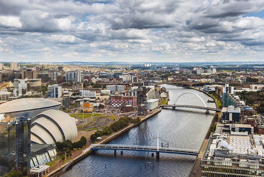
Glasgow
Situated on the River Clyde, Glasgow is Scotland’s largest city. It was founded in the 6th century when St Mungo built a church in what was then called Glasgu (meaning ‘dear green place’). In the 15th century, it granted the status of a royal burgh. With the discovery of the New World, Glasgow, facing westwards towards the Americas, came into its own. The city’s merchants made excellent profits trading in tobacco, sugar, ginger and spices, cotton, coffee, and timber.
During the Industrial Revolution, Glasgow expanded at an enormous rate, and the industries of cotton milling, shipbuilding, and heavy engineering made the city one of the world’s largest industrial centers. By the early 1900s, about half the world’s ocean-going ships built on the Clyde.
Since the Second World War, heavy industry has declined, and shipbuilding has almost disappeared. In recent years, many areas redeveloped and many new businesses now flourish in the city.
Driving directions Scotland
The Google maps and Google Satellite maps of Scotland above showing the country, located next to Ireland and England. For your further reference, the latitude and longitude coordinates of Scotland are variable, , while the capital, Edinburgh, found at 55 57 N 3 11 W.
When you are traveling around Scotland, Edinburgh, or its other cities, use this routing tool, providing up to date route planning service free of charge.
Look no further; get accurate driving directions in Scotland, Europe, by filling the route planner form below.
[xyz-ihs snippet=”routing”]
Since Google acquired and introduced its digitalized maps in 2004, you’re probably familiar with its base functions, like finding an address or driving directions to locations. Still, Google maps also accommodate bicyclists, pedestrians, and also public transportation with special directions and customizable routes.
Navigate the countries in Europe faster and easier while driving, use the interactive Google maps for your driving directions. The continuously updated database contains over 220 countries and territories digitally mapped, hundreds of millions of businesses and places around the world positioned on the map.
Get fresh GPS navigation, traffic, and transit information – no matter what part of the Scotland, Edinburgh, any other city and country in Europe, or the world you’re in.
Do you like this Scotland information page? Please don’t forget to share it with others! Thank you.
25 thoughts on “Scotland”
Comments are closed.